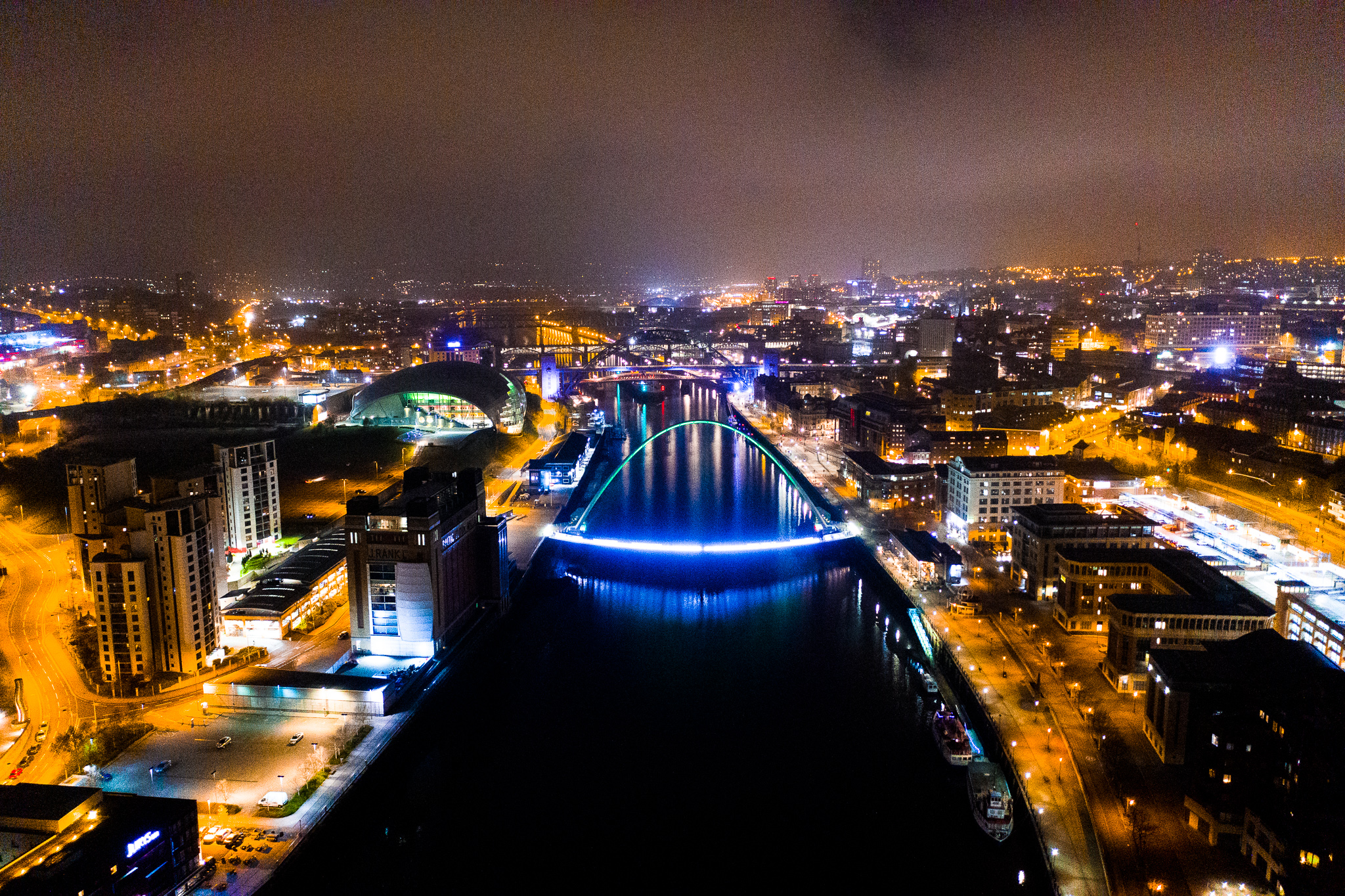
What if you could promote your business, venue, products or services or capture moments from your wedding day from the sky? The results of a bird’s eye perspective in each of these scenarios are amazing. It will capture the hearts and minds of your target customers or leave you with stunning visual memories of your special occasion. Whatever industry you’re in or whatever reason for your aerial photography, we can provide high quality 4k video and raw file photographs.
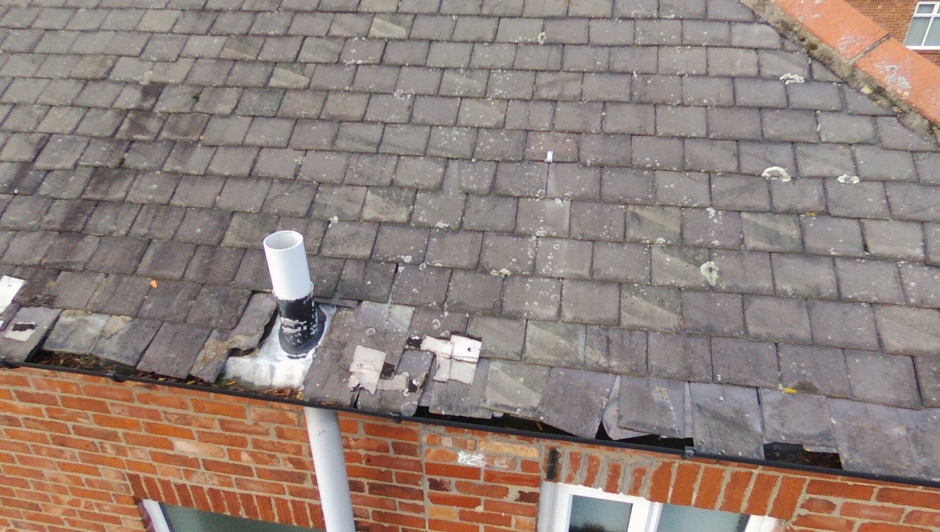
Roof condition and inspection
A mundane, risky but extremely important job. Especially in an emergency situation! We carry out standard or emergency roof condition surveys to find evidence of slipped, damaged or missing roof tiles. Aerial photography is the most safest, innovative and efficient way to capture this important structural information
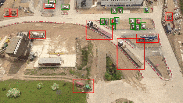
Land and site surveys
Surveying large sites and vast areas of terrain can be costly and time consuming. Using drone photography, we can survey your site or land within 15 minutes. Using the footage, we can produce, volumetric reports, digital terrain models and 2D and 3D maps. All of which can be accessed by you via data cloud software. Your reports will be stored and can be used for further mark-ups and analysis.
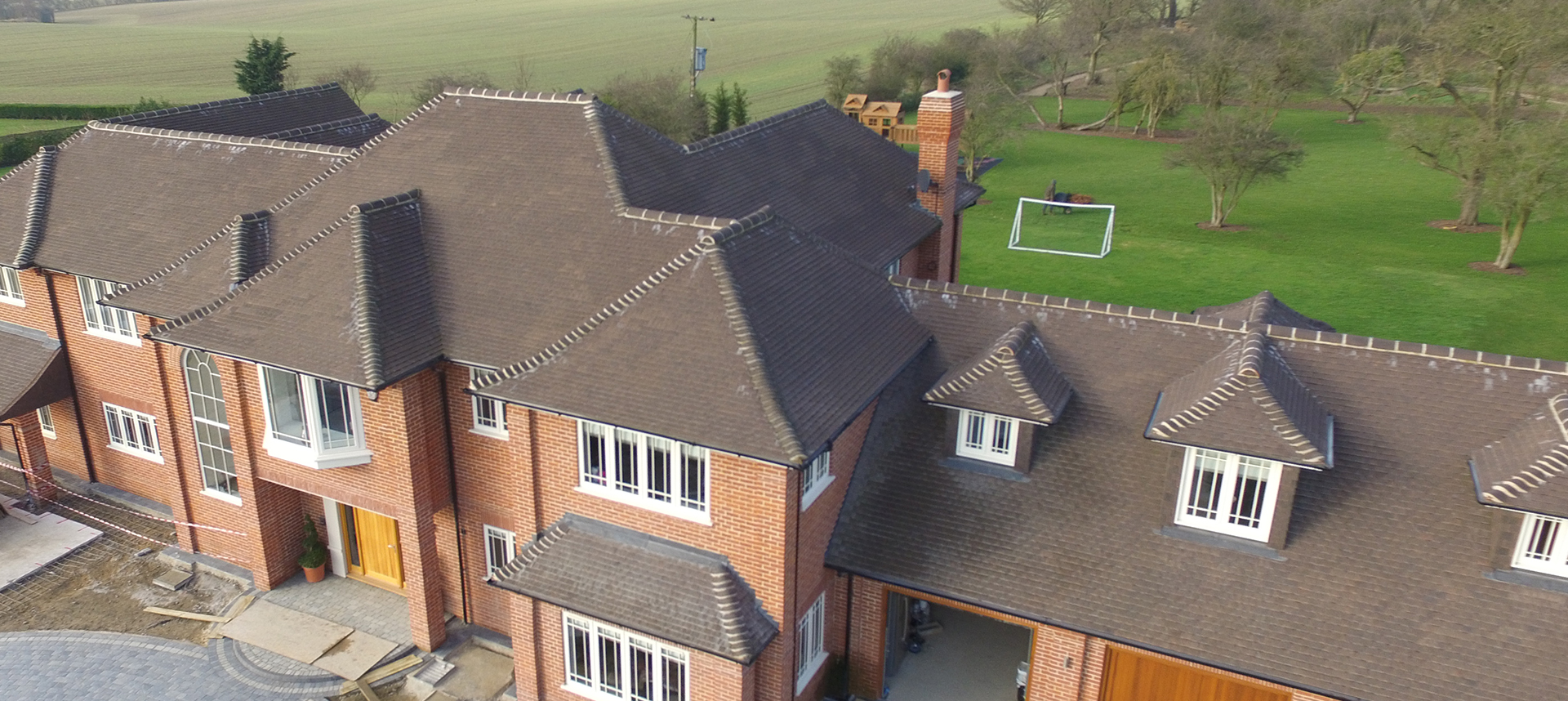
Aerial property marketing
If you’re in the market for selling a property, improve your chances with drone photography. It’s something completely different and will inspire any perspective buyer to come along and take a closer look. We’ll provide you with a bespoke service that includes high volume packages with multiple high quality photos and videos.
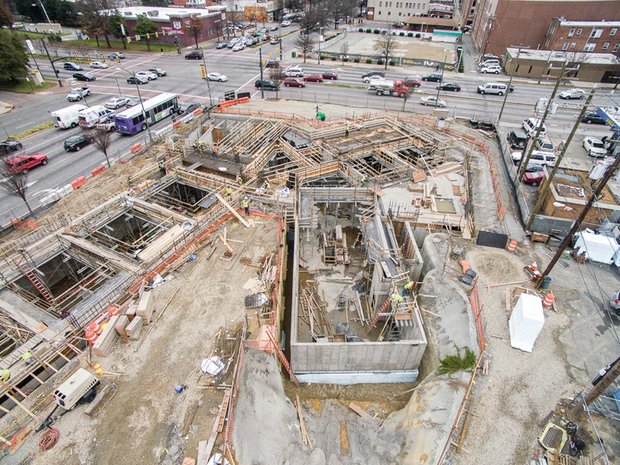
On site progress reports
Keeping on top of and reporting weekly progress can be challenging when you’re running or managing a large construction project. We’ll come to your site on a week by week basis and capture aerial progress photos. For example, logging works carried out to date that can be used for valuation purposes or as photographic evidence for any future delays claims.